.svg)

.svg)

.svg)
.svg)
.svg)
%201%20(2).png)

.svg)
.svg)


.svg)
.svg)
Today, environmental managers and operations spend countless hours collecting data from the field.
This is tedious, time-intensive work:
- Logging emissions data on paper
- Transferring data from paper to digital
- Begging accounting for production records
- Emailing spreadsheets back and forth with operations
- Calling and emailing that really busy plant manager for their logs
- Fixing all the data entry errors you found right before the reporting deadline
Operations already has a job to do: Getting product out the door, improving production processes, and running equipment. Data entry tasks unnecessarily add to their workload
And us environmental folks hate to ask operations for data just as much as they hate logging it. Yup, it makes us both grumpy.
We’re ending manual environmental data collection with two major updates to our product: A data collection API and mobile data logging.
New Feature #1: Automating data collection with the Mapistry API
From January, Mapistry customers can integrate Mapistry directly with their data sources. This could be sensors, operations systems, or other databases storing air or water data.
Instead of manually entering this data into your spreadsheets, it will flow automatically, daily, weekly, or minute-by-minute, to give you:
- A real-time view of your limits, including limit alerts
- Automated record keeping of all data your permits require
- Reliable data without typos or unit conversion errors
In combination with Mapistry’s calculations and analytics features, the API will automate 80% of the resources you previously needed to maintain spreadsheets, all while reliably preventing record-keeping fines and limit exceedances.
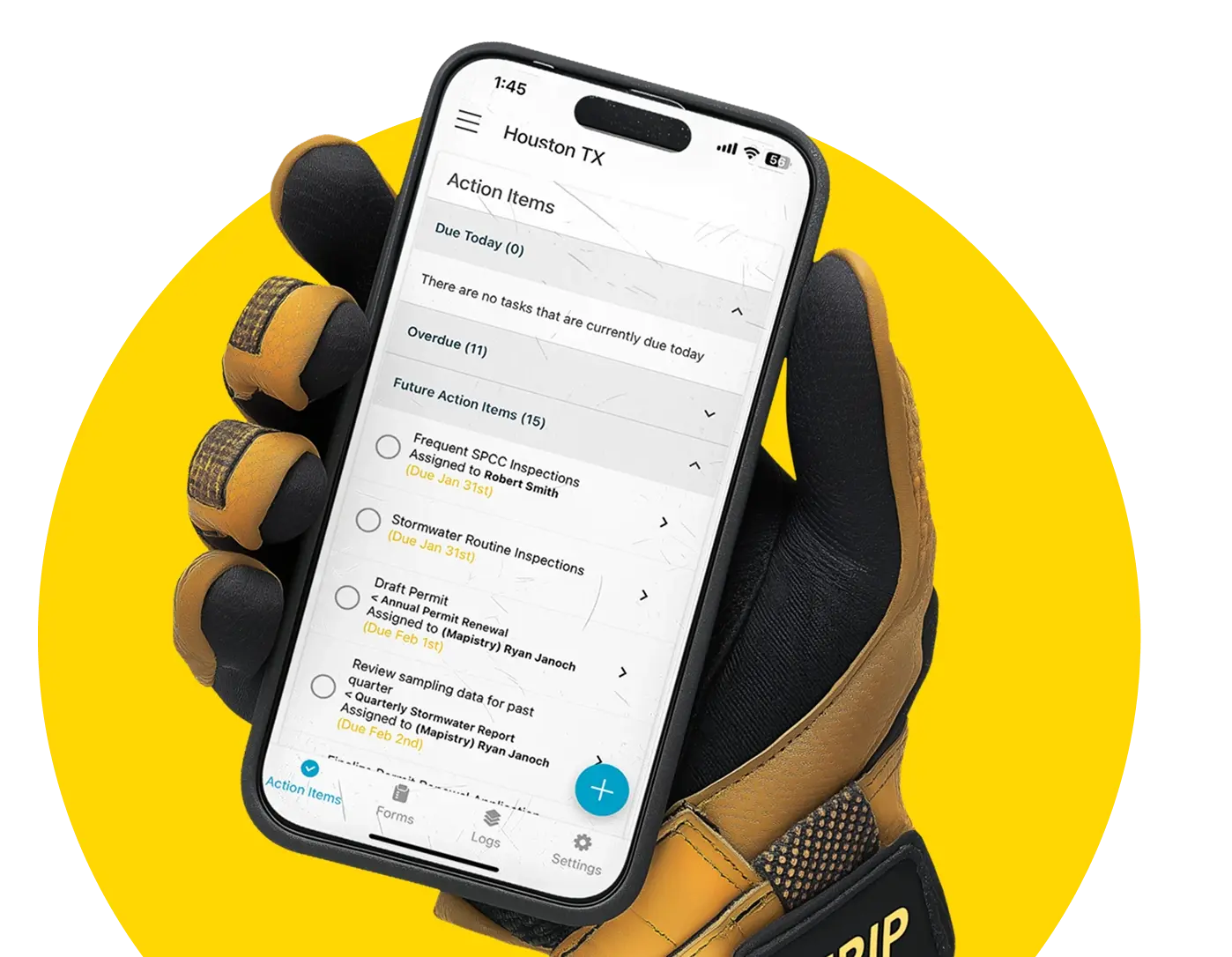
New Feature #2: Logging data in the field from the mobile app
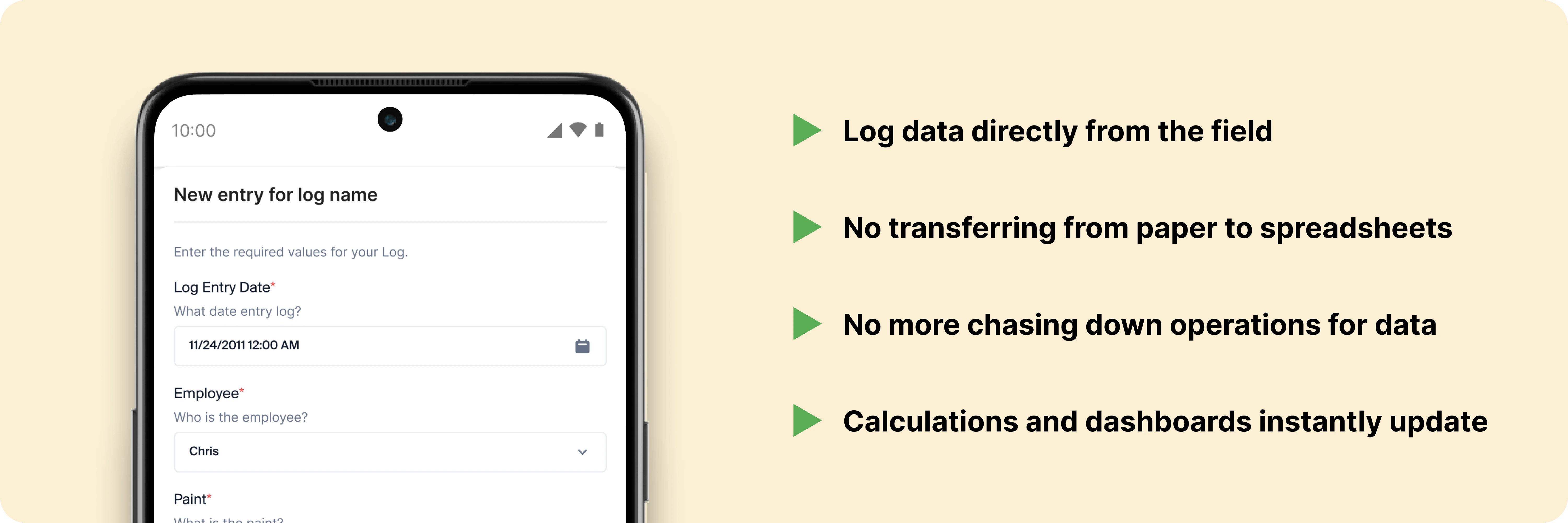
There will always be some field data that you need to log manually.
Previously, operations teams logged this data on paper, transferred it to a spreadsheet, and sent it to the environmental manager, who merged data from different locations into one (terrifying) master spreadsheet.
With the paper & spreadsheet method, your team repeatedly handles the same data, wasting hours and causing errors that eventually result in fines.
To address this, we’re adding mobile logging to the Mapistry app.
As of January 3rd, 2024, your operations & environmental teams can use the app to:
- See what data to log and how often to log it
- Directly log data in Mapistry from their phones in the field
- Prevent overwriting data or unit conversion errors
- Instantly update calculations and dashboards as new data arrives
Later in 2024, you can also log data from locations without internet access.
Who can use the new features, and when will they be available?
With the release in early January, mapistry customers with the Advanced tier will automatically get access to data logging in the Mapistry mobile app. Fully automating data collection with API access is included with Mapistry’s Enterprise tier and will also be available in early January.
Join our launch webinar to see the new features in action
We hosted a webinar on January 16 to show you the new API and mobile logging features. Our team will also show you how to use the new features based on real-life examples from industrial applications.
You can watch the webinar recording here.
If you’d prefer a personal demo with our sales team, please book a demo with us.
For our technical friends who want to know how the API works, take a look at the documentation here.