.svg)

.svg)

.svg)
.svg)
.svg)
%201%20(2).png)

.svg)
.svg)


.svg)
.svg)
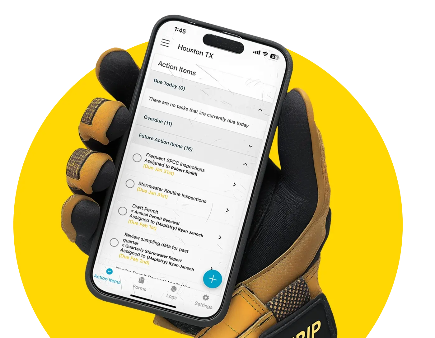
Keep track of deadlines and tasks
No more Outlook, Post-Its, or overflowing email inboxes. Stay on top of your to-dos with Mapistry’s compliance calendar.
See all deadlines at a glance
Outlook is great, but it wasn’t built for compliance.
Keep better track of to-dos and deadlines with a dedicated compliance calendar you can share with your team.
-2.webp?width=2000&name=Image%20(1)-2.webp)
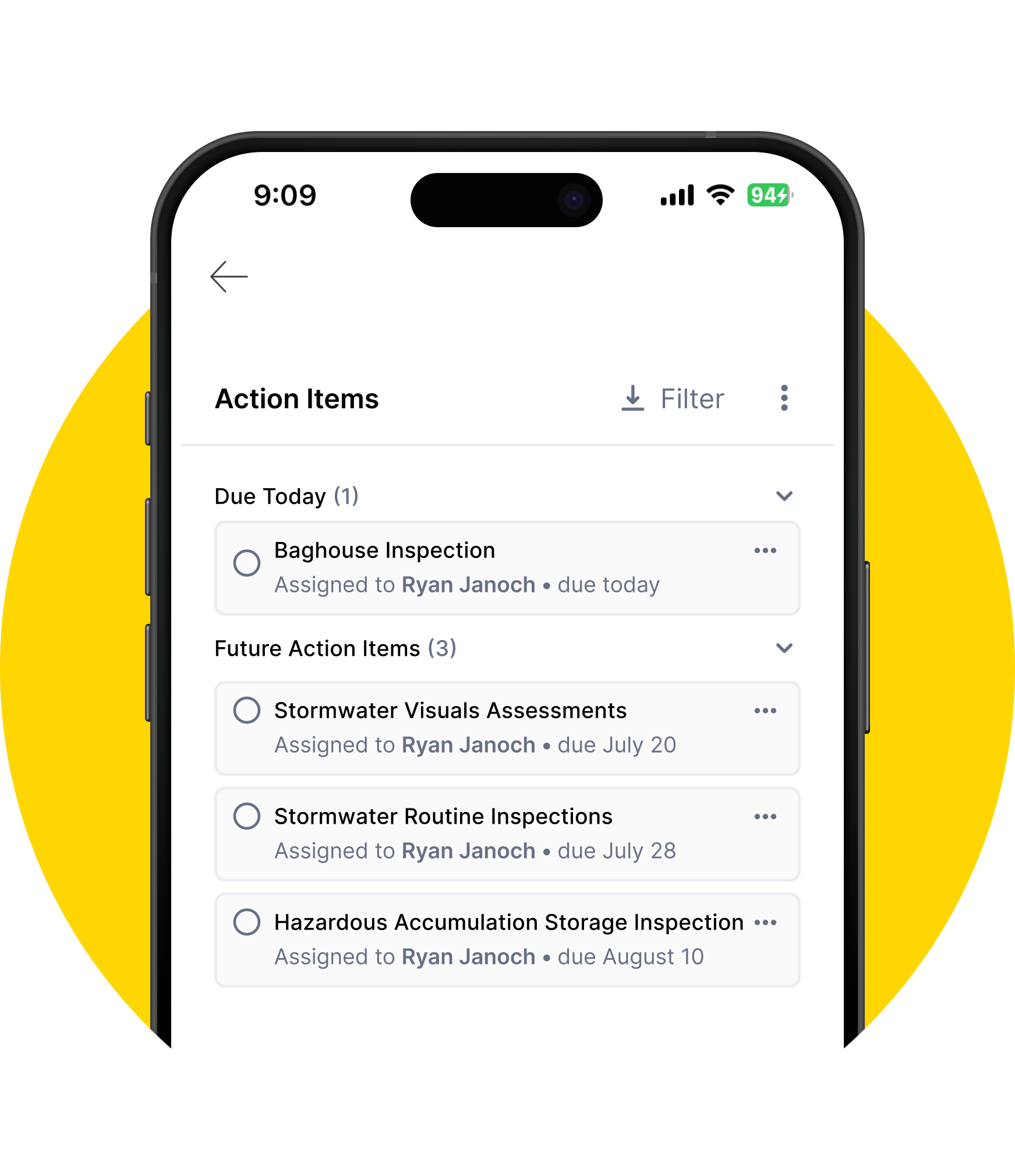
Give operations simple to-do lists
No worries about training your operations team on a new tool.
With one look at the Mapistry mobile app, they’ll always know what to do, and when to do it.
-2.webp?width=2000&name=Image%20(2)-2.webp)
Easily delegate tasks & projects
Need some help from your team?
Level up your teamwork by creating tasks, adding detailed instructions, and automating task notifications.
-1.webp?width=2000&name=Image%20(3)-1.webp)
Automate reminders
Don’t waste your time on following up on overdue tasks. Mapistry’s already on it!
Set up automated emails to make sure tasks don’t get missed.
-1.webp?width=2000&name=Image%20(2)-1.webp)