
Creating Map-Linked Location Fields from the Form Builder
See more details on the Form Builder/Configure Form page here and here- Within the Form Builder, you can add a "Location" field. Location fields act as site-specific single or multi-select drop-down fields when completing a form, even if sites use the same original form. Only features on an individual site's map for layers tagged with the same tag as selected for the Location field will display as select options for that particular site. Common examples include Tank locations or discharge locations/outfalls.
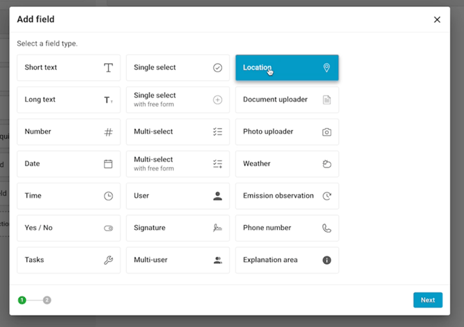
- To add a Location field to a form in the Form Builder, click on "Add new field" and select "Location"
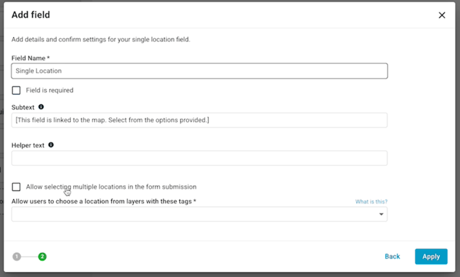
- Name the Location Field (ex: "Tank" or "Discharge Location").
- If the field should be a multi-select field, check the box for "Allow selecting multiple locations in the form submission"
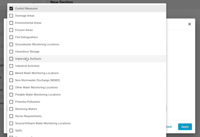
- Select the map layer tag(s) - this will make it so that all features on any Map layer with the same tag(s) as selected for the Location field will display as select options for that particular site. To link an item in the map to a form, start by making sure the layer you want to use (ex., Discharge Locations) is tagged properly in the map (see how to do this)
- Note: most of the time, one layer tag is enough (ex: Layers tagged as "Tanks" for a "Tank" Location field). However, you can select multiple tags if needed (ex: a Location Field for "Inspection Area" that is tied to two Layer tags "Industrial Areas" and "Potential Pollutants"
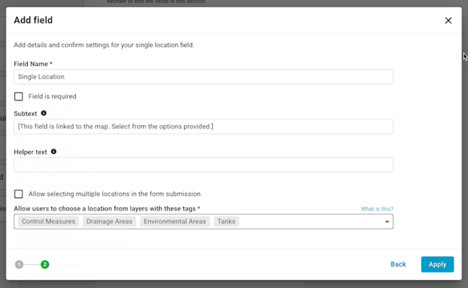
- Note: most of the time, one layer tag is enough (ex: Layers tagged as "Tanks" for a "Tank" Location field). However, you can select multiple tags if needed (ex: a Location Field for "Inspection Area" that is tied to two Layer tags "Industrial Areas" and "Potential Pollutants"
Tying the Map-Linked Location Field to a Map Layer Tag:
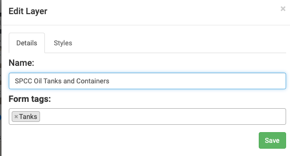
To link an item in the map to a form, start by making sure the layer you want to use (ex., Discharge Locations) is tagged properly in the map (see how to do this). All items tagged properly will appear as an option in the appropriate droplist when completing an inspection form or editing a template.
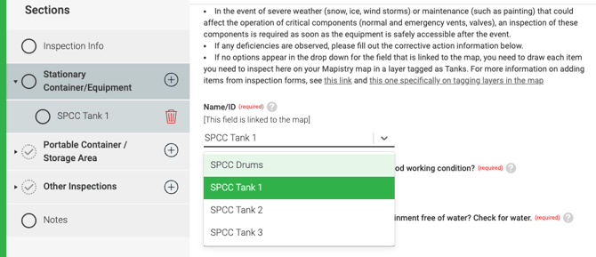
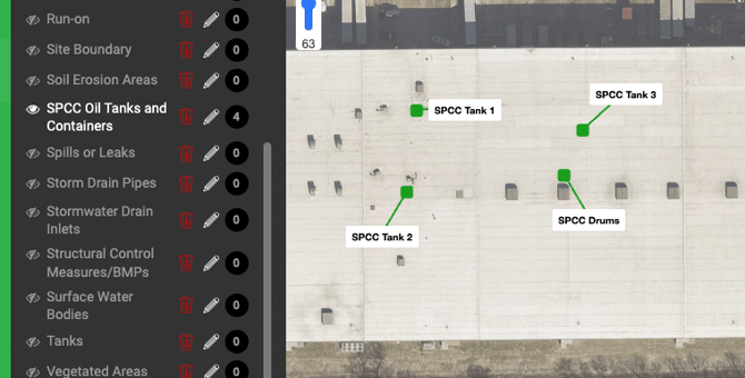
For example, an SPCC inspection may have a field where the oil tank/container name from the map can be selected. This field in the form is pulling in the "Feature Names" from the site map for any layer tagged "Tanks."
Tip: To more easily find which Layers in the map are tagged for inspections, name your layers "Inspection Areas: SPCC Tanks" or "Inspection Areas: Stormwater"
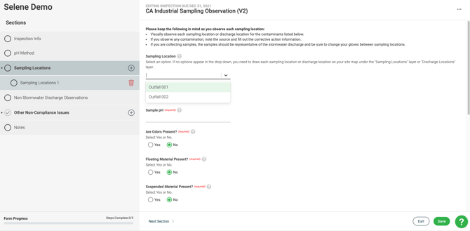
Or another example, the Stormwater Visual Assesment form below gives the options Outfall 001 and Outfall 002 when clicking on the Sample Location question. Outfall 001 and Outfall 002 are items on the map tagged as Discharge Locations with Stormwater as the water medium type.
End of Article
Support
If you have any questions or need further assistance, please e-mail help@mapistry.com.